
University of Cincinnati: Mill Creek Planning and Design
In the spring semester of 2021, the University of Cincinnati’s College of Design, Architecture, Art and Planning (DAAP) orchestrated a comprehensive cluster of classes. Guided by Urban Planning Professor Shilpa Mehta, the cluster focuses on analyzing and designing solutions for the Mill Creek watershed.
With the Mill Creek Alliance serving as a resource, partner, and client, staff and students uncovered and presented the diverse fabric of the watershed through a series of connected courses with varying study focuses and techniques. The cluster is made up of topics including regional planning, planning foundations, landscape architecture, neighborhood planning, geospatial information and analysis (GIS), and planning theory.
Course outcomes are featured on websites, Esri GIS storymaps, and public presentations at the close of each semester. The resulting foundation of knowledge will serve as a launchpad for all future UC courses that treat the Mill Creek watershed as an area for study and design.
Regional Urban Planning Studio
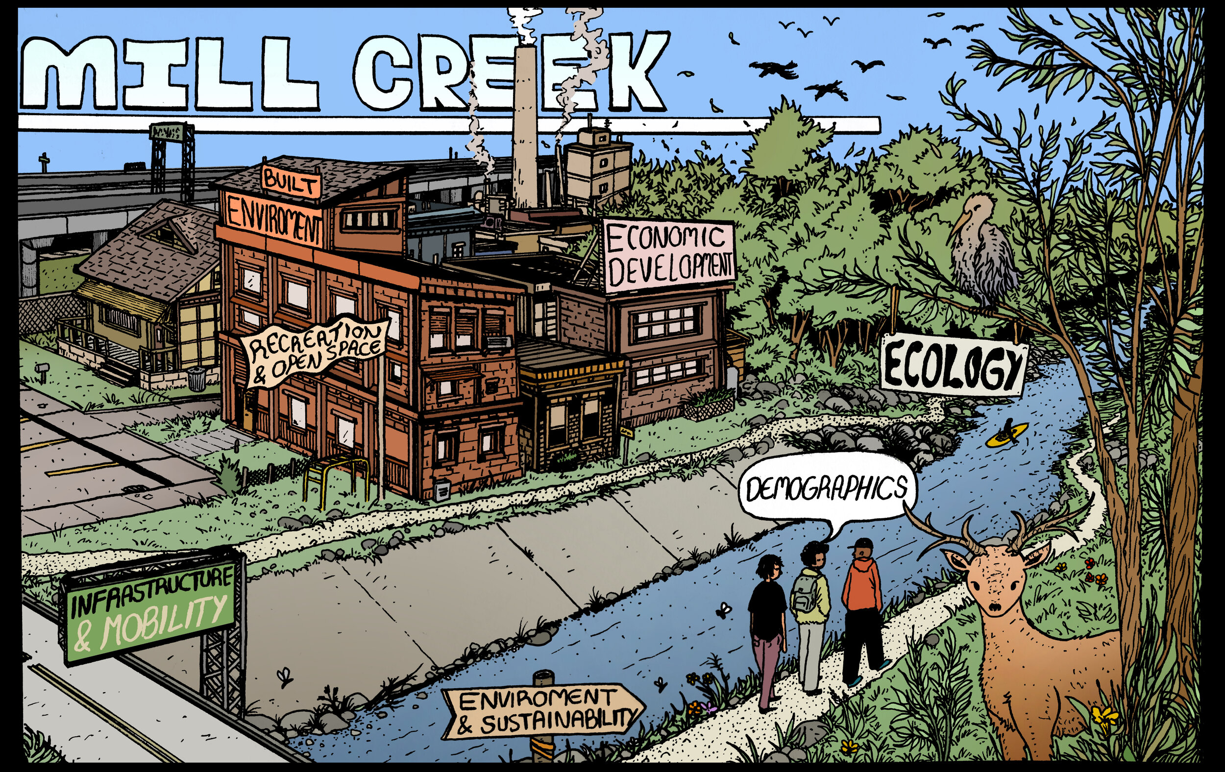
Students, led by Instructor Greg Dale and Co-Instructor Woolack Kim, created an Esri arcGIS storymap collection that covers an analysis of demographics, ecology, economic development, the built environment, infrastructure, mobility, the environment, and open space throughout the watershed.

GIS Project Formulation & Management
Led by Professor Xinghao Wang, 13 students used various GIS software to complete three analysis projects about geospatial topics in the watershed.